Our Services
- Topographic Survey
- Hydrographic Survey
- As-Built Survey Services
- Demarcation and Boundary Surveys
- GPS Surveying
- Pipe Line Surveys
- Survey Equipment Rental Services
- 3D Laser Scanning
- GROUND PENETRATING RADAR (GPR)
- Gate Level Computation Fixing Surveys
- Digital Terrain Modeling (DTM)
- Check Surveys
- Measured Building Surveys
- Monitoring Surveys
- Update Surveys
- GIS Data Collection
Global Presence
- Professional Survey Engineering Consultancy LLC
- P.O. Box: 132972, Abu Dhabi – UAE
- Email: info@professional-surveys.com
Tel: +971 2 5501090Fax: +971 2 5501090Mob: +971 50 3213022
- Enquire Now
Digital Terrain Modeling (DTM)
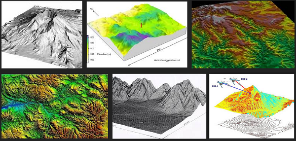
Our topographical surveys are surveyed in 3D. Therefore in addition to providing contoured plans, we are able to provide 3D digital terrain models (DTMs) on disk. This is a computer generated “wire-frame” model of the topography of the site. These can be rendered if required.
We create DTMs for most topographical surveys that we carry out; as this is used for the creation of the site contours. We can also produce site cross-sections by utilizing this information, if required.We often provide 3D “triangle” file DTMs to clients for them to use for site volume calculations, optimum design levels etc.Please also refer to our check surveys section and our topographical survey section for associated information.

