Global Presence
- Professional Survey Engineering Consultancy LLC
- P.O. Box: 132972, Abu Dhabi – UAE
- Email: info@professional-surveys.com
Tel: +971 2 5501090Fax: +971 2 5501090Mob: +971 50 3213022
- Enquire Now
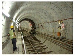
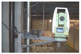
We undertake monitoring surveys to identify movement or deformation in any environment using precise digital levels, movement detectors, precision survey instruments and high accuracy reflector-less total stations. We can map small changes in vertical movement, level and horizontal movement or full 3D XYZ coordinate differences in either real-time or over long periods to demonstrate changes and trends.
Monitoring projects have included; major bridges and structures, sea defense, soil embankment stability, historic buildings, Steelwork, retaining walls and ground settlement at landfill site.
|
|